
Rediscovering Japan

Rediscovering Japan
Travel (Saga Part 1 (Ureshino Onsen/Takeo Onsen/Yoshinogari))

by tomizuta
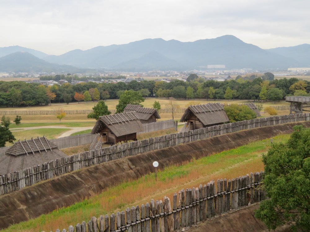
A view of a reconstructed village and an inner moat at Yoshinogari Historical Park, the site of an ancient settlement that thrived from 5th century B.C. to 3rd century A.D. Looking north to the Sefuri Mountain Range which is the border separating Saga and Fukuoka prefectures.
In early November 2021, the fourth wave of COVID 19 was rapidly subsiding. I went to Nagasaki to attend a Buddhist ritual in memory of a relative who had passed away in December 2020 amidst the third wave. People were cautiously resuming a more normal way of life, including postponed funeral rituals. I hadn’t really traveled outside of the Kanto Region since visiting Aomori close to a year ago. I thought of taking the opportunity of my travel to explore the neighboring prefecture of Saga that I had never visited before. Based on the odd bits of knowledge on Saga, mostly accumulated while studying in preparation for the national certification test for National Guides of Japan, I had picked up a couple of places of interest. Saga is the smallest prefecture in Kyushu, and the 6th smallest in Japan, so I thought I could cover all the places in two days. After the ritual, we left Nagasaki City and headed to Ureshino Onsen in the area close to the border with Nagasaki Prefecture.
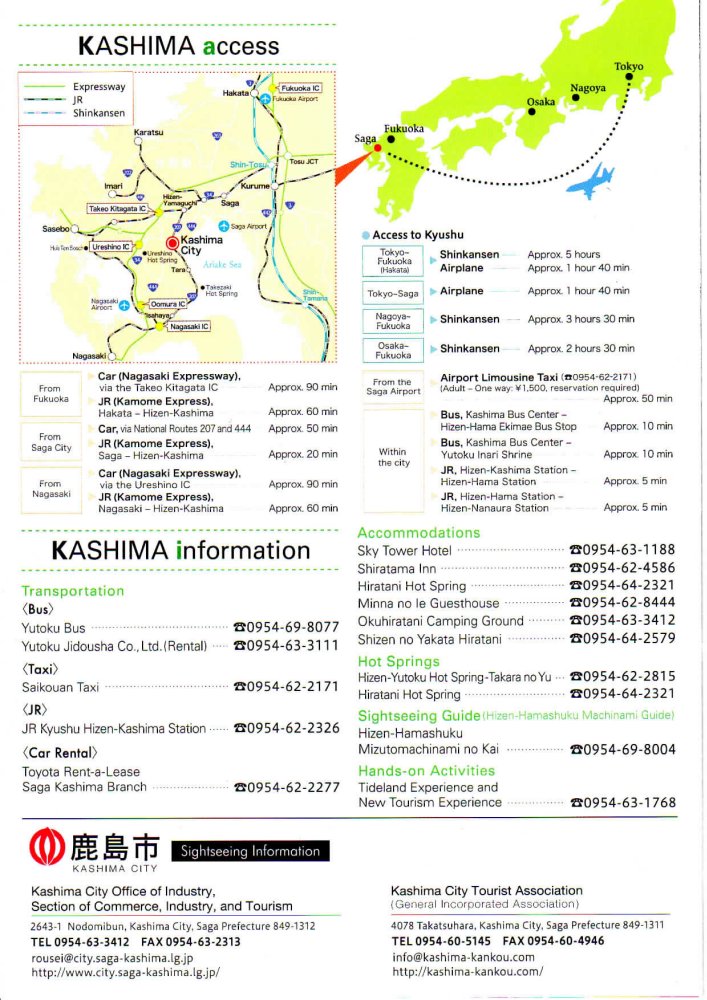
I really struggled to find an English map of Saga. I finally found this on Kashima City's website. Although the map is small, it'll give you an idea on how I traveled. I started from Nagasaki City in the very bottom to Ureshino hot spring (onsen) just left to the large Kashima City sign. From there I headed to Yoshinogari, which is not shown on the map, but lies east of Saga City om the upper right. Then drove west to the coast to Karatsu City on the upper left, after which I went south to Imari City, then Kashima City and finally back to Nagasaki Airport.
We had a pleasant stay at the ryokan. It was a Sunday, which traditionally is the best day of the week to stay as many have to work from Monday. Perhaps it was due to the increase of those working remotely from home, but the ryokan was almost full judging from the crowded parking space. Registration was quick and we were momentarily shown to our room facing the river flowing below and the hills on the back. We were warmly welcomed by the lady staff that accompanied us to the room and brought our welcome snack. It appeared all the ryokan staff were happy with the return of travelers, where a couple of weeks back they may have been more concerned of the pandemic.
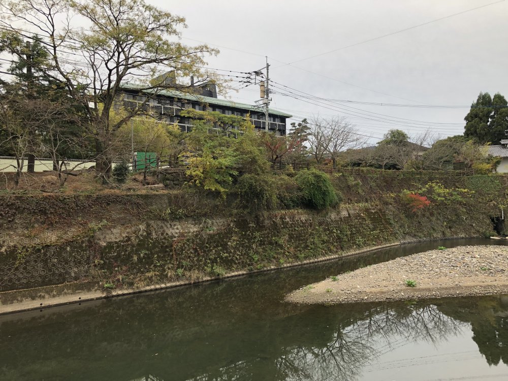
Registration was quick and we were momentarily shown to our room facing the river flowing below and the hills on the back. Our ryokan and the high street is located in the opposite direction.
The following morning we had an early breakafast and set out early to allow
time for our visit to Yoshinogari in the eastern area of Saga Prefecture.
I had wanted to explore the onsen district of Ureshino, but had to skip
on this occasion, as I was advised most of the places would not have yet
opened. Before Yoshinogari, there was another place I had planned to visit.
This was the Romon of Takeo Onsen, another onsen about 10 kilometers north
of Ureshino. I had surfed the internet to find that there was a guided
tour early in the morning. The Romon is the entrance gate to the public
bath of Takeo Onsen open to all designed by Kingo Tatsuno, the architect
that designed Tokyo Station among many other famous buildings. The Romon
was completed in 1915.
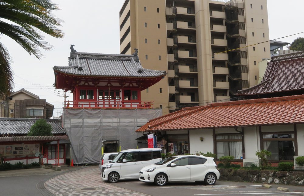
View of the Romon from inside the onsen facility. Unfortunately the exterior of the Romon was being refurbished. The building on the right is the oldest facility andcurrently under use as a public bath facility. The admoission office is behind the parked cars
I asked about the tour at the admission office. The ticket was 450 yen per person. The admission staff guided us to the bottom of the gate. I had thought it was a guided tour, but he told us that we were free to explore the upper floor of the gate, adding that our ticket was inclusive of a bath at the public bath. We went up the narrow stairs to the second floor. There was a display of a minuature replica of the buildings with some drawings in the middle, and an elderly volunteer guide wearing a yellow coat was guiding another visitor.
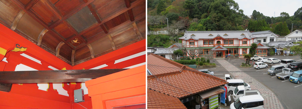
The ceiling with one of the four Chinese Zodiac signs (left) inside the Romon, and the view commanded from the second floor of the Romon, with the honkan on the left and shinkan in the back (right).
The guide gave us a lot of information. It was apparent that he had a lot of pride for Saga. Kingo Tatsuno was born in Saga, and a local entrepreneur had asked the famous architect to design a new building for Takeo Onsen. Tatsuno initially declined, as he was in the middle of the Tokyo Station construction, but eventually accepted. His original design was a triple gate of which only one was finally completed. Construction was undertaken by the current major construction company Shimizu Corporation. Of the 12 Chinese Zodiac signs, eight reliefs can be seen at Tokyo Station, and the remaining four can be found here, evidencing Kingo’s two contemporaneous works.
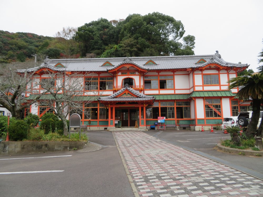
The Shinkan (new building), constructed at the same time as the Romon, and by the same architect/constructor team. One of Kingo Tatsuno's rare Japanese style architecture.
We left the guide and the Romon and went across the car park to the Shinkan (new building), constructed at the same time as the Romon, and by the same architect/constructor team. It is called the new building as the main building (honkan) constructed in 1876 shortly after the Meiji Restoration. The entire Romon, honkan and shinkan site was a honjin (lodging place for feudal lords on their trips to and from Edo) on the Nagasaki Kaidou. Based on such history, the Shinkan was formerly used as a recreational staying place for the military. It went into disrepair after its use as a public bath was discontinued in 1973, but refurbished in 2003. It was designated as an important national cultural property in 2005 and currently serves as a museum of Takeo Onsen (admission free). It didn’t take long to view the ladies and mens' baths as well as the grander first class and three private mens' baths most likely for higher ranking military staff and wealthy people. It was an interesting visit to one of the oldest resort facilities in Japan.
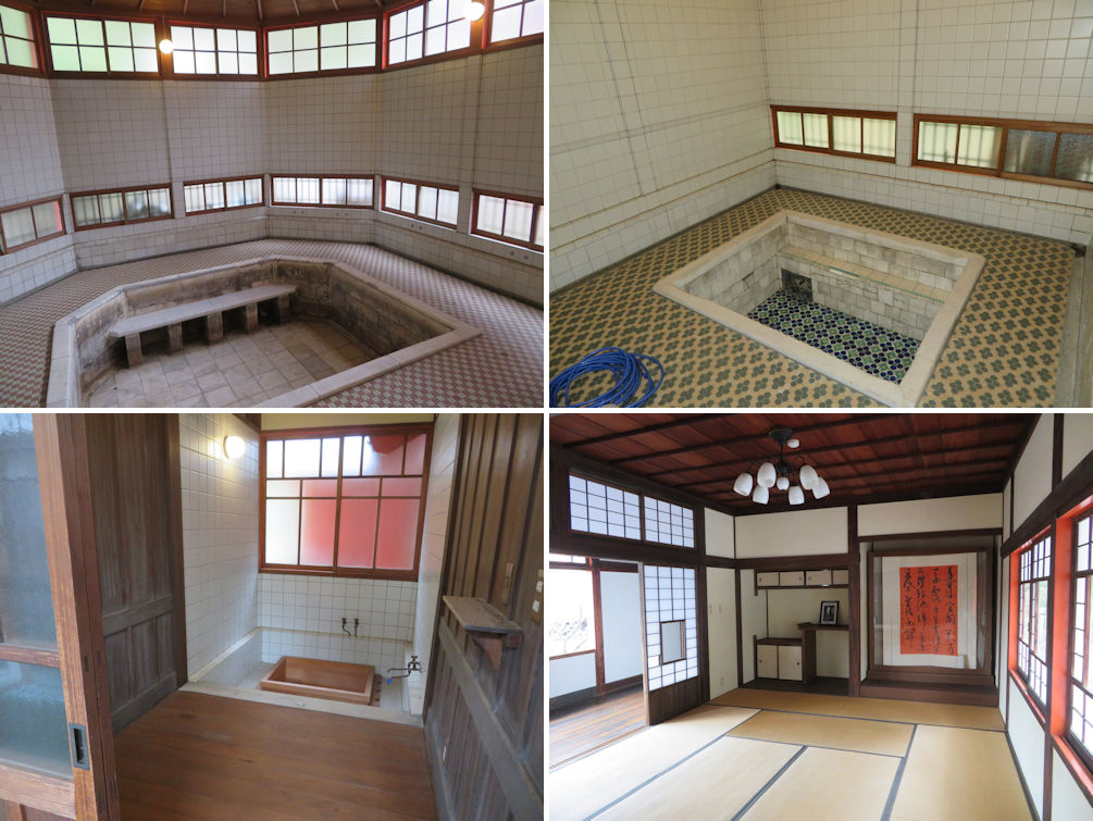
The main mens' bath (upper left), mens' first class bath (upper right), one of three mens' private baths (lower left) and the after bath relaxation room on the second floor (lower right).
From there we drove north east to Yoshinogari, in the eastern part of Saga Prefecture. Here I need to talk a bit about Saga. Its area and population of 2,400 square kilometers and 800,000 people are both the smallest of the seven prefectures in Kyushu and the sixth smallest among the 47 prefectures in Japan. The area is still larger than Tokyo, Osaka or Kanagawa. In addition to some paleolithic sites, some Jomon era sites have been found in Saga City. The sea level then was much higher, and inland areas such as Saga City was at the seafront. From the late Jomon period Saga was under much influence from the Asian Continent as Busan in Korea is only 200 kilometers away, including the import of rice growing and art such as pottery as well as settlers to Japan. One of the most prominent archaeological site from the period is Yoshinogari. In the feudal area, Saga had two feudal domains, Karatsu han (domain) and Saga han. Saga han was based in Saga City with the Nabeshima family as the feudal ruler.
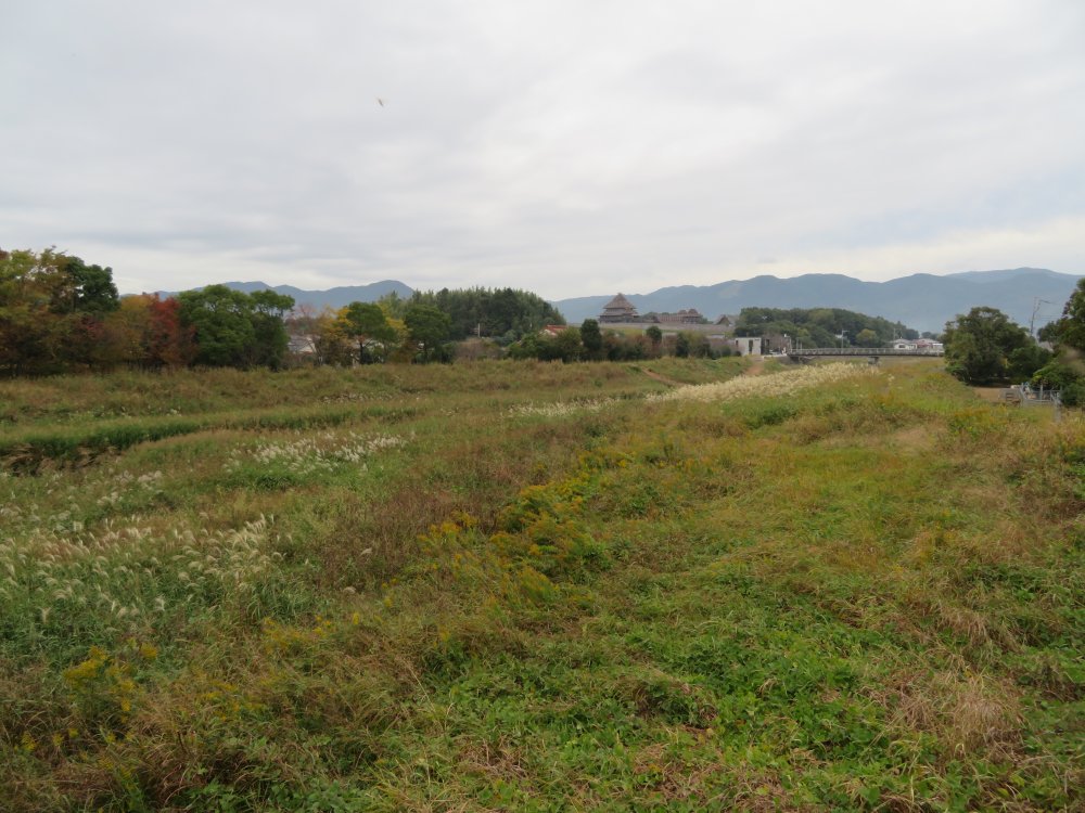
View of the moat-enclosed settlement of Yoshinogari from the south east.
It took about an hour to travel to Yoshinogari Town. The Yoshinogari site is the largest archaeological site of the Yayoi era found in Japan to date. The Yayoi era is the period following the Jomon era until the Tumulus era represented by the large tombs built between the middle of the 3rd century to the 7th century. The name Yayoi comes from Yayoi in the Tokyo Shinjuku area, where pottery distinctly different from those of the Jomon era was found. It was also linked to the start of rice growing in Japan, which had been thought to be the 5th century B.C. With the discovery of the Nabatake rice growing archaeological site, it is now thought that the start of rice growing was at least a couple of centuries earlier than that. Culture imported from the continent including rice growing traveled from the Kyushu area to the east. It is believed that rice growing had already started by the 3rd century B.C. in Aomori Prefecture in the Tohoku region. In this sense, I believe it is difficult to draw a line between the Jomon and Yayoi eras. Yayoi era started from the Kyushu area, while it only started in the Tohoku area several centuries later where the Jomon era lasted and prospered for a longer period of time.
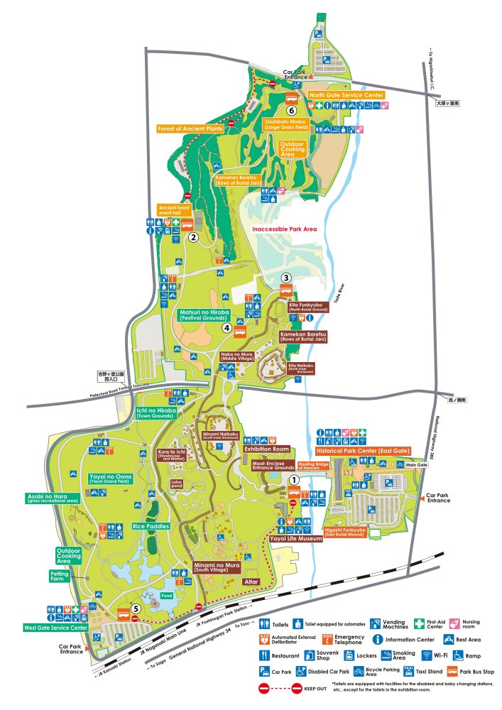
Map of the Yoshinogari site covering over 25 acres, can be obtained from the Park's website.
The Yoshinogari site is a massive area covering over 25 acres (1 square kilometer), of which the eastern side is a national park and the western side a Saga Prefectural park. The historical sites are in the western national park. There are many car parks but we made the right choice by chosing the eastern car park which is where the main gate and Historical Park Center is located. We paid the admission fee of 460 yen per person. I asked if we could visit their auditorium to gain some prior knowledge, but was advised that the facility was temporarily closed. I was told that there were volunteer guides at every spot to provide information.
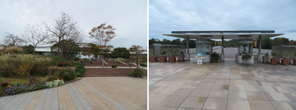
Approaching the Historical Park Center and Main Entrance from the car park (left). The main entrance gate to the Yayoi site (right).
We went through the gate, crossed a bridge over a moat, and were greeted by a volunteer guide who gave us directions to the exhibition room. The exhibition room equipped us with some advance knowledge on the areas we were going to visit.
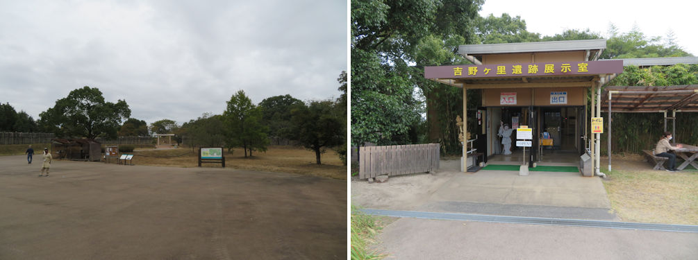
A volunteer guide gave us directions to the exhibition room (left). The exhibition room equipped us with some advance knowledge on the area (right).
We then visited the South Inner Enclosure. A signboard at the entrance to the area told us that the enclosure “is one of the two central areas of Yoshinogari. Located in the south, this area was completed surrounded by a moat and fences. A watchtower was discovered in this area as well. These findings led to the assumption that the leaders of Yoshinogari used this protected area as a residence”. We first went up the watchtower to command a bird’s eye view of the area.
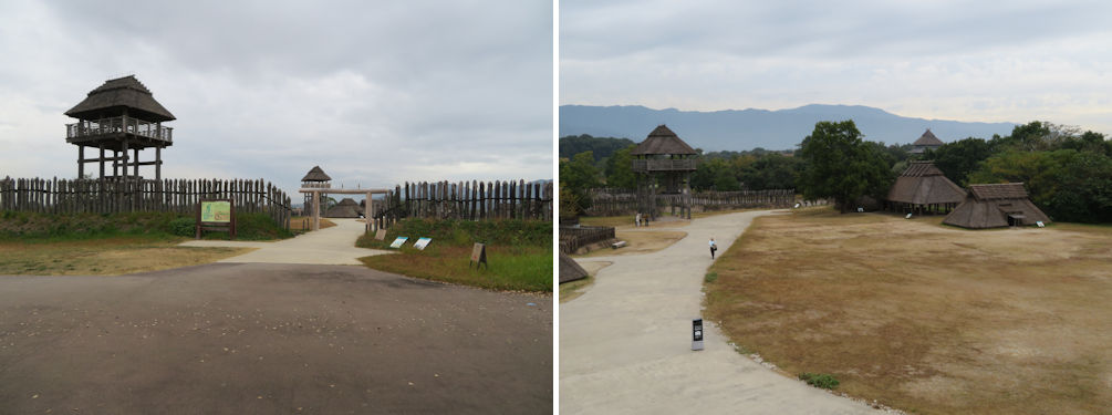
Entrance to the South Inner Enclosure (left). A bird's eye view of the South Inner Enclosure from the watchtower (right).
The volunteer guide here had quite a lot to tell us. Yoshinogari is said to be the largest moat-enclosed village. History books told us that once rice growing started, people had to secure land and water, and contrary to the peaceful Jomon period, became more belligerent and the divide between the rich and poor started to grow. I had therefore thought that moat enclosed villages meant that they had to protect the rice paddies inside the moat. I was taken aghast when the volunteer guide advised us that there were no signs of paddy fields inside the moat. His guess was that Yoshinogari was a fort of the rulers and the paddy fields were elsewhere. He went on saying that because of the close proximity to the Asian continent, people had to be prepared for attacks from the continent. “Think, Saga is only a stone throw away from the continent”.
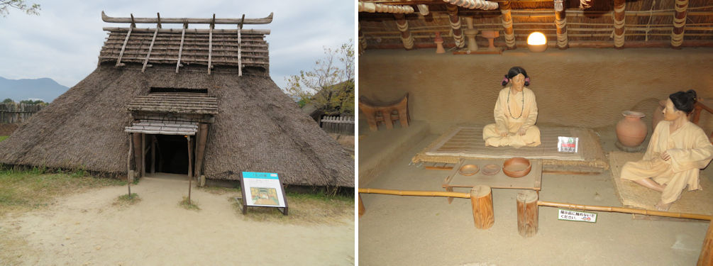
The exterior and inside of the replica of the King's residence.
We thanked the guide to head to the north inner enclosure. According to the description at the entrance to the area, “This was the most important area since all the festivals of Yoshinogari were administered from here”. It also had a sub-title for the area, “King’s Palace”. Chinese writings tell that there were many countries and kings scattered in Japan in the 1st to 3rd century. No doubt Yoshinogari had been one of them. What immediately came into sight was a huge building, the largest in Yoshinogari. This is an elevated two-story building built on 16 pillars, and is thought to be the ceremonial hall. Kings in this era are thought to have been the chief priests as well. No wonder there is a lot of similarity to Shinto Shrines, which also has a close relation to harvest festivals. We found another volunteer guide standing in front of the huge buillding. I said that the building looked similar to the Shinto shrine in Izumo, Shimane Prefecture. The guide frankly admitted that there are no blueprints of the original building except for the approximate hight from the remains of the columns, and that it had been built with the Izumo shrine in mind. There were signs advising how many people could climb up to the second floor. Our guide told us that it was because, as a building, it had to comply with fire safety regulations. I now realized why the wooden erection at the Sannai Maruyama Jomon site only had pillars but no building.
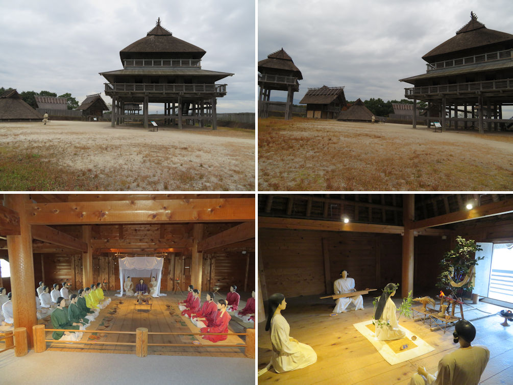
The huge ceremonial building resting on 16 pillars (upper left). The range of warehouses and watchtowers in the area (upper right). The king's court on the first floor (lower left). The priestess conducting a ceremony (lower right).
We traveled further north through a row of burial jars to the North Burial Ground facility. The burial jars were two wedged Yayoi jars containing the body and objects of the demised person. The North Burial Ground facility is built under the burial mound, so visitors may see the burial jars as they were excavated. This was quite an experience.
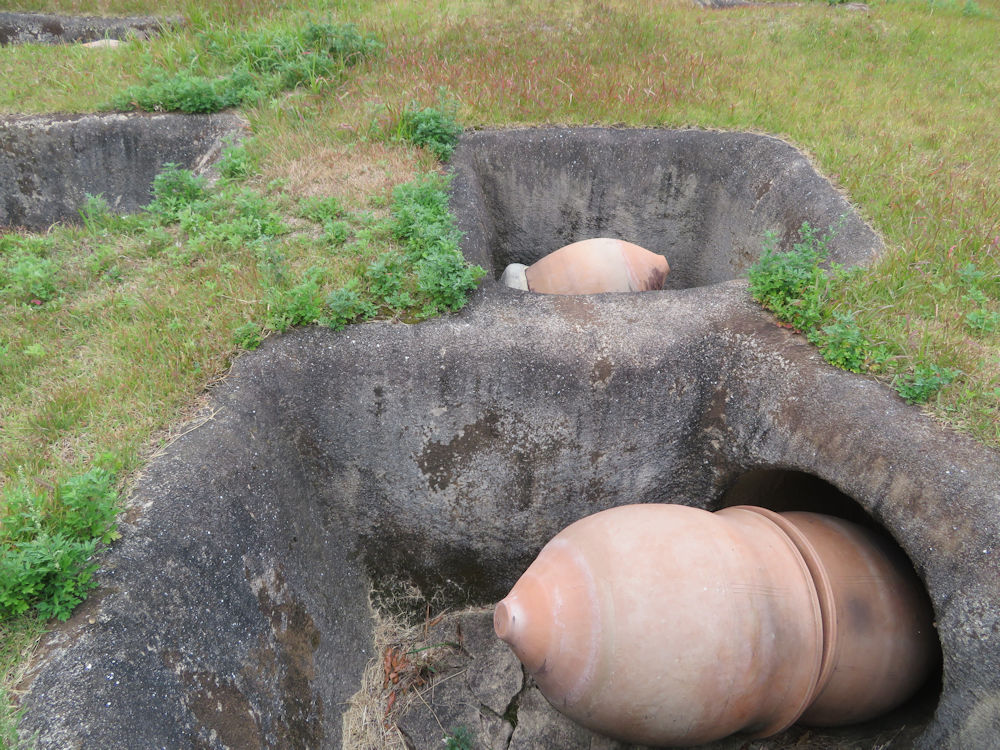
We traveled further north through a row of burial jars to the North Burial Ground facility.
The facility staff at the entrance told us to hurry if we were going to catch the bus to return to the entrance. We made it just in time. This is a convenient bus service running at 20 minute intervals making a round trip of the park. As the bus traveled south, the driver advised visitors that the right hand side (western side) of the park had many recreational spots including a festival ground and barbecue areas. We finished our tour in approximately two hours and a half. I’m sure one could spend the whole day visiting all the sites in the park. There is a giftshop and restaurant in the Historical Park Center where we had a late lunch before heading to Karatsu on the northwest coast.
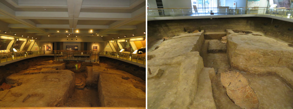
The North Burial Ground facility is built under the burial mound, so visitors may see the burial jars as they were excavated.