
Rediscovering Japan

Rediscovering Japan
Travel (Chiba City)

by tomizuta
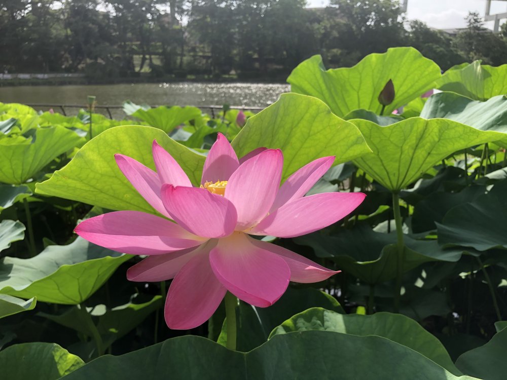
There was a lot of coverage on TV of ancient lotuses in full bloom from end June to early July, and as we found that one of the most popular places with these ancient lotuses was in Chiba City, we made a visit to Chiba Park in Chiba City, only one kilometer north of central Chiba.
Although On May 25, 2020 the Japanese government lifted the declaration of the state of emergency in the remaining prefectures of Tokyo, Kanagawa, Chiba, Saitama and Hokkaido, we remained cautious in particular because of the number of people diagnosed as positive in Tokyo. We therefore decided to make only short excursions in Chiba Prefecture for the time being. There was a lot of coverage on TV of ancient lotuses in full bloom from end June to early July, and as we found that one of the most popular places with these ancient lotuses was in Chiba City, we made a visit to Chiba Park in Chiba City, only one kilometer north of central Chiba.
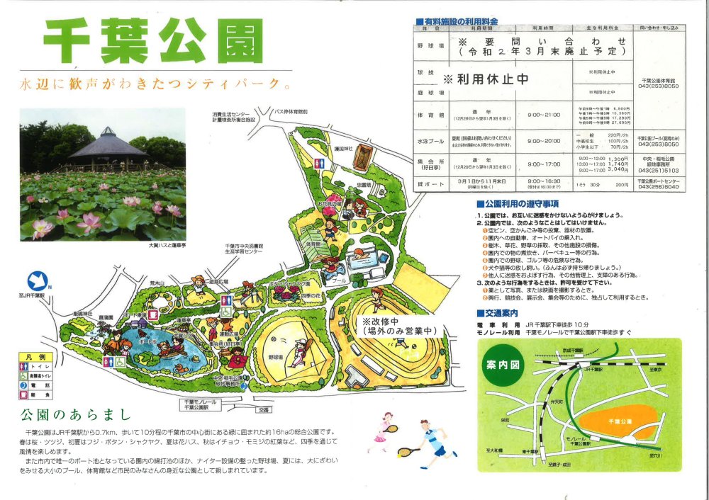
The pamphlet of Chiba Park introducing the ancient lotus on the upper left.
I suspect people know very little about Chiba City. For overseas visitors arriving at Narita Airport, they just go directly to their hotels in Tokyo, and I myself am ashamed how little I knew about the city. Chiba City has a population close to a million, which makes it the twelfth largest city in Japan. People settled in the area from ancient times as evidenced by the existence of Kasori Shell Mound, dating from 5,000 to 3,000 B.C., and one of the largest shell mounds in Japan. Despite its ancient history, the Chiba City area did not receive much spotlight until after the Meiji Restoration when Chiba City became the prefectural capital of Chiba Prefecture (which was only because the prefecture was created by the merger of the Inba area and Kisarazu area and Chiba City was on the border of the two areas). One reason was the non-existence of a powerful feudal lord with the exception of the Chiba Family (descendants of the Taira or Heiji samurai warriors) who ruled the area from the 11th to 15th century. In the Edo era, it was part of the Sakura feudal domain.
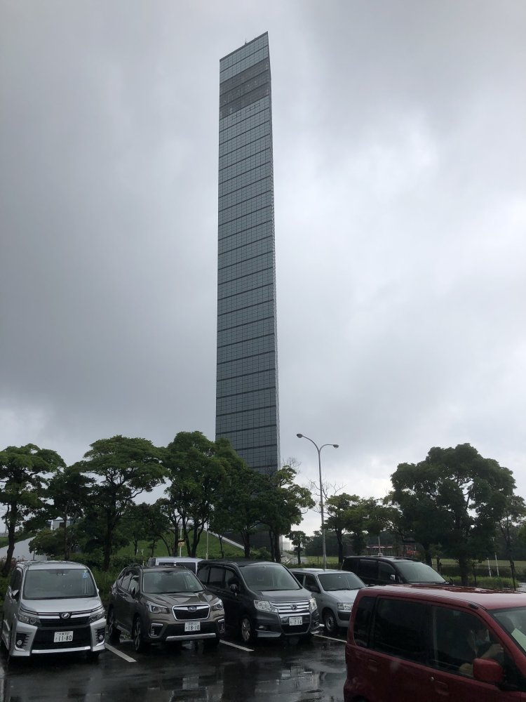
Chiba Port Tower, a 125 meter tall tower opened in 1986. An elevator takes you up 110 meters to the fourth (top) floor which is an observatory floor from where you can command a 360 degrees view of Chiba City and the surrounding areas. The third floor houses an observatory restaurant and the second floor a romantic "Sunset Boulevard" from where you can take the elevator to the ground floor. Admission fee is 420 yen but free for those aged 65 or above. Port cruises initiate from a pier adjacent to the tower.
Chiba City first started to expand as a military base of Japan’s Imperial Army. The Railway Regiment was stationed in Chiba and Narashino. Aircraft manufacturers also founded factories in the adjacent areas. After WWII, land reclamation on the Tokyo Bay side of the prefecture progressed rapidly as the area became a huge industrial are with power generation, steel manufacturing and petrochemical complexes etc. started operation. With the industrialization, the Port of Chiba has become one of the three largest ports of Japan alongside Yokohama and Kobe.
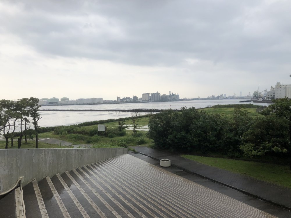
View of Chiba Port looking south from Chiba Port Tower. From the left, a power generation plant and a steel manufacturing plant.
Chiba Park was opened as a municipal park several years after WWII on the former site of Railroad Regiment No. 1, where a baseball ground, multi-purpose stadium (which used to host cycling races), gymnasium, swimming pool and other facilities were gradually opened. The baseball ground has been discontinued and planned to be converted to public open space. The multi-purpose stadium is in the process of being rebuilt. There was a temporary car park on the northern edge of the park for visitors coming to see the ancient lotuses. There is no parking fee or admission fee to the park.
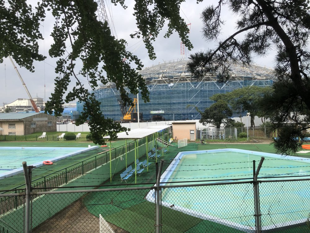
The swimming pools and the multi-purpose stadium under reconstruction in the back.
All of the athletic facilities are located on the north side of the park, as may be seen in the park pamphlet above. From the car park, we passed by the outdoor swimming pools and headed south to the pond where the ancient lotuses are. Here I need to talk about the lotus, called Oga lotus. Peat for fuel used to be harvested in Kemigawa, about 7 kilometers west of the town center of Chiba City and part of the city. Several years after the end of WWII, a Neolithic canoe made of wood from around 1000 B.C. was found in the peat bog, which led to an excavation. Two more canoes and a lotus receptacle were found. Dr. Oga, a botanist and lotus expert carried out further excavation that led to the discovery of three lotus seeds, one of which he succeeded to germinate and bloom in 1952. The lotus gained worldwide recognition as the Oga Lotus. From the seeds and roots, Oga Lotus has been successfully cultivated all around Japan, including Chiba Park.
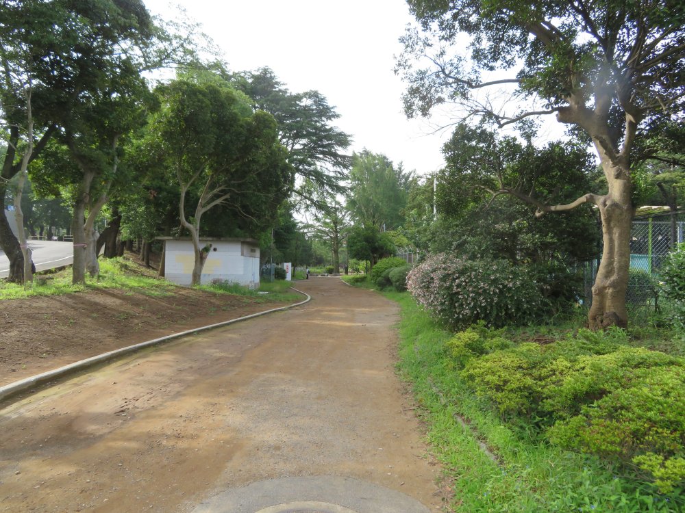
From the car park, we passed by the outdoor swimming and headed south to the pond where the ancient lotuses are.
It was during the monsoon season, but the rain had let up and with the
sunshine it started to get quite warm, which made me feel uncomfortable
wearing a mask. There were quite a few visitors already but everyone was
quite conscious of keeping a social distance with other visitors. The lotus
flowers were over their peak, but there were still more than three hundred
to enjoy. The purple flowers are very beautiful and much bigger than I
had thought. It is a pity that they only last a few days. The lotus receptacles
are also very unique. There is a wooden passage that takes visitors through
the middle of the lotuses.
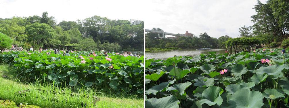
There were quite a few visitors already but everyone was quite conscious of keeping a social distance with other visitors (left). Looking south to the pond from the middle of the lotus area (right).
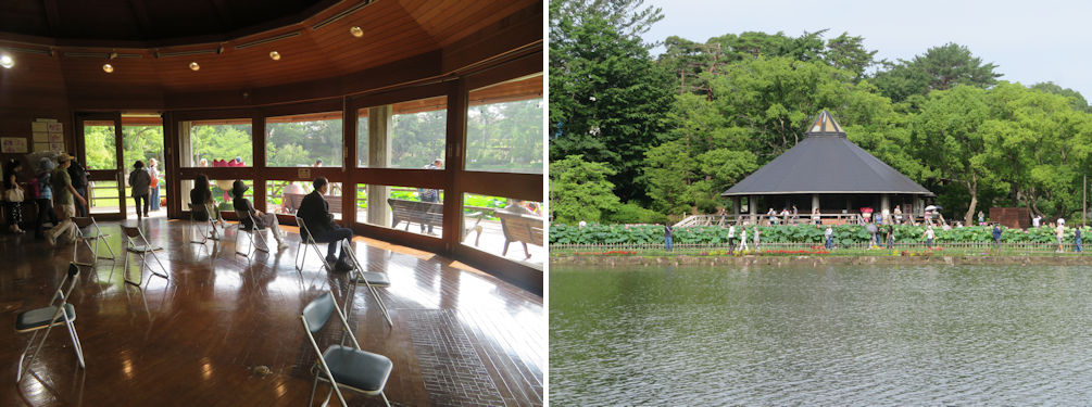
There was a visitors’ rest house, with some background history of the lotuses. Here again the chairs had been arranged to maintain social distance. From there we took a different route on our way back. We went around the lake to the opposite side of the lotus.
You can enjoy a view of the entire iris park as well as Lake Yodaura from the observatory deck.
There are quite a few flowering plants in the park. Quite noticeable in the middle of the park was a field of purple agapanthus in full bloom and the hydrangeas also in their peak. There were also some scattered orange iris close by.
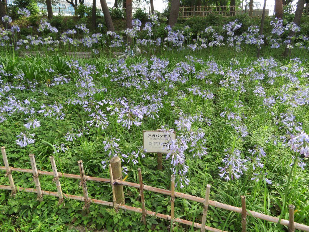
Quite noticeable in the middle of the park was a field of purple agapanthus in full bloom.
As the park is on the former site of Railroad Regiment No. 1 of the old Imperial Army, there are some remaining remnants including a tunnel built for training purposes. It reminded me that the Shinkeisei Line running between Shin-Tsudanuma and Matsudo was built on the rail tracks originally built by the regiment. It was a very interesting and rewarding visit that I would recommend to travelers especially around this time of the year.
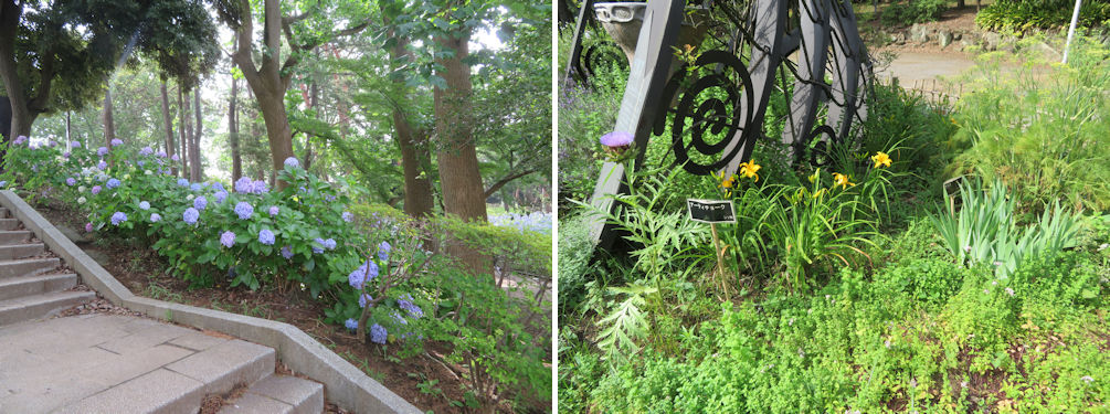
The hydrangea and orange iris.
On another occasion, I made a visit to the Kasori shell mound I touched upon in the introduction of Chiba City. The shell mound is on a hill mound of about 30 meters above sea level and located 3 kilometers east of the city center of Chiba City. An area of 151,000 square meters has been acquired and preserved by Chiba City. The site is comprised of the North Shell Mound, South Shell Mound, some reconstructed houses and the Kasori Shell Mounds Museum. It is a fifteen minutes’ walk from the nearest bus stop or monorail station, so it’s much better to drive there.
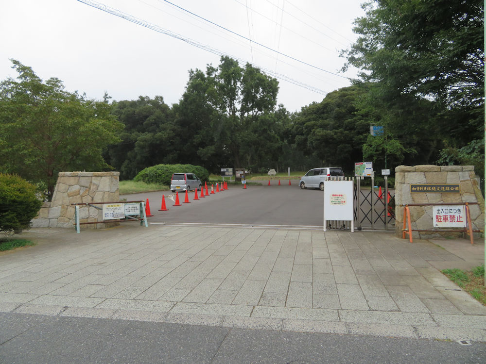
The entrance to Kasori Shell Mounds is from the west side. The North Mound is directly ahead, and the South Mound on the right behind the trees.
I had been taught at school long ago that shell mounds were garbage sites, but with the discovery of human skeletons buried in the mounds, the understanding now is that at least some of the shell mounds such as Kasori had a spiritual aspect as well. In Japanese history, we are taught of a Jomon Period followed by Yayoi Period, so named from the type of pottery. Jomon pottery has rope patterns (Jomon) pressed into the clay. The name Yayoi comes from a place in Tokyo where Yayoi pottery was first discovered. Jomon Period is a period of over 100 centuries, from 14,000 B.C. to 800 B.C. (from the pamphlet of Kasori Shell Mounds Museum, but there are other views such as from 14,400 B.C. to 250 B.C.). The North Shell Mound was developed from 3,000 B.C. to 2,000 B.C. and the later and larger South Shell Mound from 2,000 B.C. to 1,000 B.C.
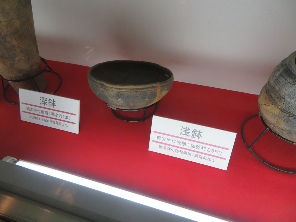
The shallow pot in the middle was excavated from the South Shell Mound. The pot is of a Kasori B3 type, named after the excavation spot.
I parked at the temporary car park outside the park which has been provided while the car park inside the park is closed due to construction work, and entered through the west gate. I inspected the map by the entrance and decided to take the side path to the observatory tunnel of the stratum section of the South Shell Mound and then head to the museum via the South Shell Mound.
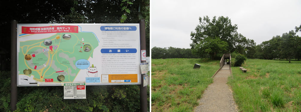
Site map (lft) and the view of the side path to the South Mound and the observatory tunnel (right).
This was my first experience to view a stratum section of a shell mound. It was intriguing to see the actual stratum in the observatory tunnel with the heaps of various shells and remnants of fish and animal bones.
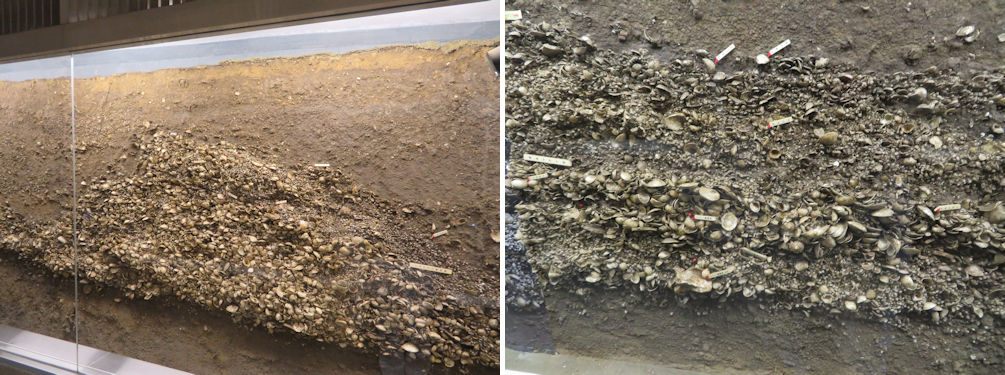
The cross section of the South Shell Mound (left) and a closer view (right). The red dots in the lower area indicate bones of wild boar.
I followed the side path through the South Shell Mound. The mound is covered with grass and weeds, so one wouldn’t know that you were walking over an archaeological site were it not for the various signs indicating the center of the mound etc.
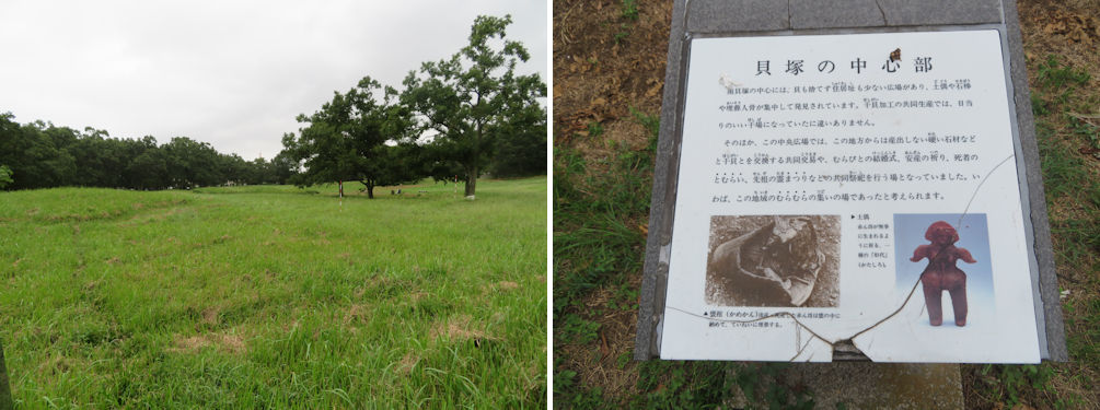
View of the eastern side of the South Shell Mound (left). The sign indicating the center of the South Mound (right).
There was a sign in front of the museum celebrating the designation of Kasori Shell Mounds as a Special historic site under the Act on Protection of Cultural Properties in 2019. This is equivalent to a national treasure under the same Act, except that buildings and objects are designated as national treasures, while historic sites with historical and academic importance and landscape including gardens with artistic and scenic value are designated as Special historic sites. Kasori Shell Mounds was the 62nd site and is one of four from the Jomon Period and the first and only shell mound to be designated as a Special historic site. I introduced the national treasure Venus of Jomon, an earth-baked female doll excavated at the Togariishi Jomon Special historic site in Chino, Nagano Prefecture. Please click here to jump to the article.
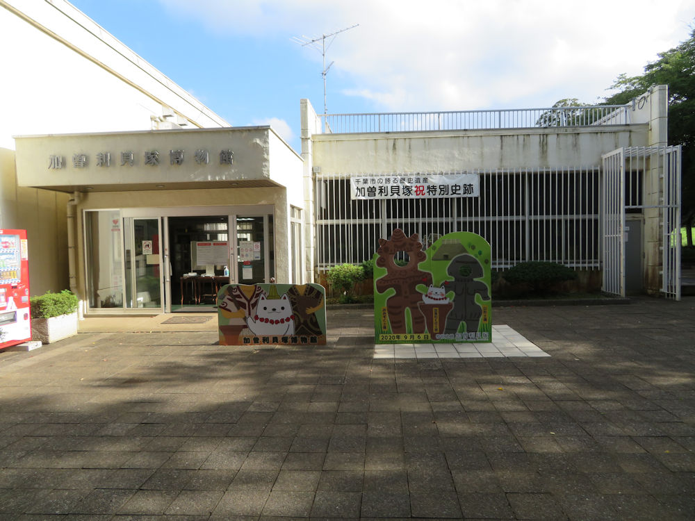
There was a sign in front of the museum celebrating the designation of Kasori Shell Mounds as a Special historic site under the Act on Protection of Cultural Properties in 2019.
There was noone at the entrance hall. I helped myself to the museum pamphlet and map and watched the introduction video of the shell mounds and museum which was quite informative but only in Japanese. The displays mainly constitute of the excavation history, the excavated objects including various pottery. Two types of pottery, Kasori E type from the North Shell Mound and Kasori B type from the South Mound are recognized as distinguished styles in the development history of Jomon pottery. This was the first time I learned that of the 2,400 Jomon shell mounds found in Japan, 800 was in the Tokyo Bay area, of which 120 were in Chiba City.
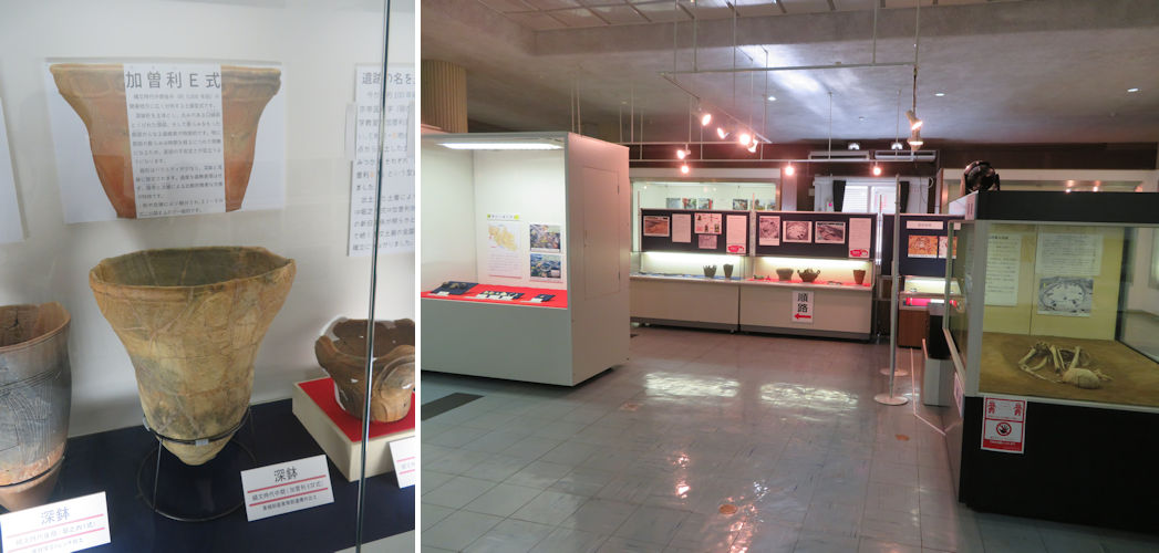
Kasori E type pottery (left) and inside the museum (right).
English description is very limited, but they have a helpful English pamphlet that you may ask for at the museum entrance hall (you need to ring a bell at the entrance desk to seek assistance).
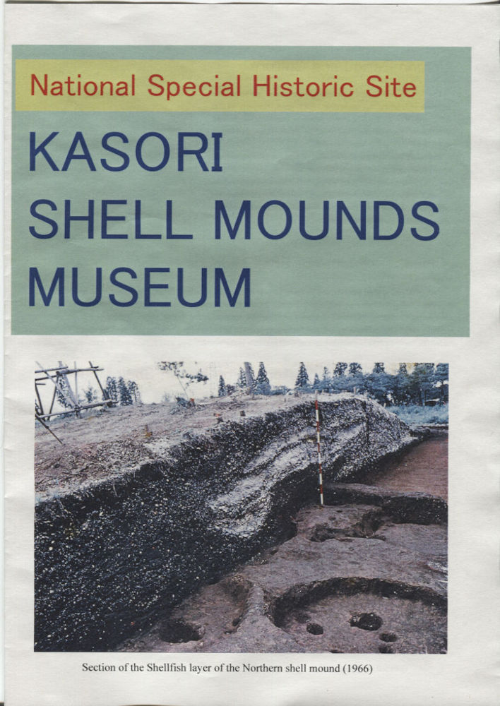
They have a helpful English pamphlet that you may ask for at the museum entrance hall.
I left the museum to visit the reconstructed Jomon houses in the South Mound area. Of the three houses only one was open for entry. I’d seen reconstructed Jomon houses before in other places such as the Togariishi Jomon Special historic site in Nagano. I took a few pictures and headed to the North Shell Mound which is closer to the park entrance gate.
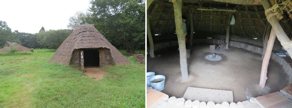
The reconstructed Jomon dwellings (left) and its interior (right).
Unfortunately, I could not get to the center of the North Mound due to construction work. However, the observatory tunnel was open. I made a quick tour as it was quite warm and humid in the tunnel with a dense smell of the soil.
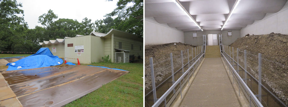
I could not get to the center of the North Mound due to construction work (left). However, the observatory tunnel was open (right).
I should not forget to mention that there is an Edo period residence a little downhill from the museum building. The building was relocated from Makuhari Town in the west of Chiba City. It was built between 1741 to 1750 and served as the governor’s office of the area. I never had the opportunity to visit this site although I’ve lived 40 years in Chiba Prefecture, but was quite impressed and felt that it deserved more recognition for its significance in Jomon history.
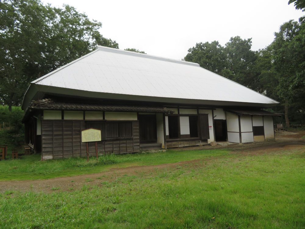
The former Oosuka residence was relocated from Makuhari Town in the west of Chiba City. It was built between 1741 to 1750 and served as the governor’s office of the area.