
Rediscovering Japan

Rediscovering Japan
Travel (Tokyo (Nihonbashi/Kandabashi River Boat Cruise))

by tomizuta
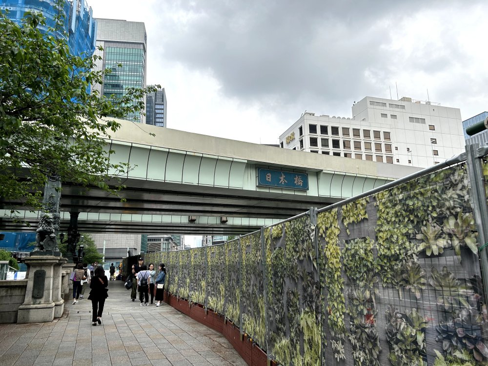
A view of the eastern side of Nihonbashi Bridge from the northern side. What seems like a bridge above with the sign "Nihonbashi" is the Metropolitan Expressway C1.
In March 2024, I was asked by a European travel company to guide a family visiting Tokyo for the first time. They were staying at a hotel close to Yurakucho, slightly east of the Imperial Palace Grounds. The travel company had a list of places that I must include in the 8 to 9 hours tour. Asakusa, Tokyo Skytree, Imperial Palace Grounds are places I regularly include in my guided tours. But I struggled with the other place on the list, Nihonbashi. Other than show Nihonbashi (meaning Japan Bridge), a bridge which is introduced by the Public Relations Office of Japan that it was “completed over 110 years ago in 1911, is a stone double-arched bridge standing 49 meters long and 28 meters wide. In 1999, it was designated a national important cultural property. It has a statue of the mythical qilin beast erected at its center and karajishi lion statues at the bridgeheads on each side”, point out that the bridge served as the starting point of all roads leading to other parts of Japan from the Edo era, and show the modern department stores and shopping district, was it worthwhile for a family visiting Japan for the first time to spend time? Actually, because of the poor weather on the day, I omitted Nihonbashi from the places to visit with the agreement of the family. But I left Nihonbashi for my homework, and had decided to study further.
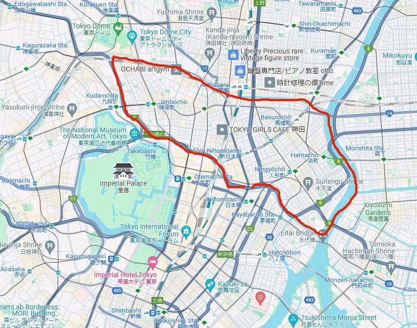
A map extracted from a Google Map of the Chuo and Chiyoda Cities (Wards) in Central Tokyo. We traveled along the red line clockwise, starting from and ending at Nihonbashi.
Coincidentally, a week or so later, my wife found a 90 minutes’ river cruise starting from Nihonbashi, along the Nihonbashi River, Kandagawa River, Sumidagawa River and back to Nihonbashi. Eager to learn more about Nihonbashi, we went on the cruise in late April. There were over 30 people and the meeting point was on the north eastern side of Nihonbashi. There was a sign board tucked in a corner that told me this was part of the Nihonbashi Riverside Fish Market that spread east to the Edobashi bridge area. The fish market flourished for three centuries, until the fish market was relocated to the Tsukiji area following the Kanto Earthquake in 1923 (The Tsukiji Fish Market was relocated to Toyosu in October 2018).
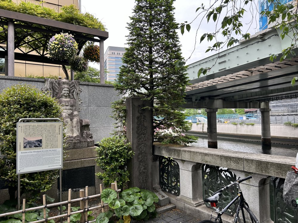
On the north eastern side of Nihonbashi, there was a sign board tucked in a corner that told me this was part of the Nihonbashi Riverside Fish Market that spread east to the Edobashi bridge area.
The tour conductor took us to the south eastern side of the bridge, and
then down a slope to the pier on river level. I did not know of this pier
until this occasion. The boat had seating capacity of slightly less than
forty without any roof. We were advised that it didn’t matter where we
sat, as we would all be looking upward in general. The river cruise started.
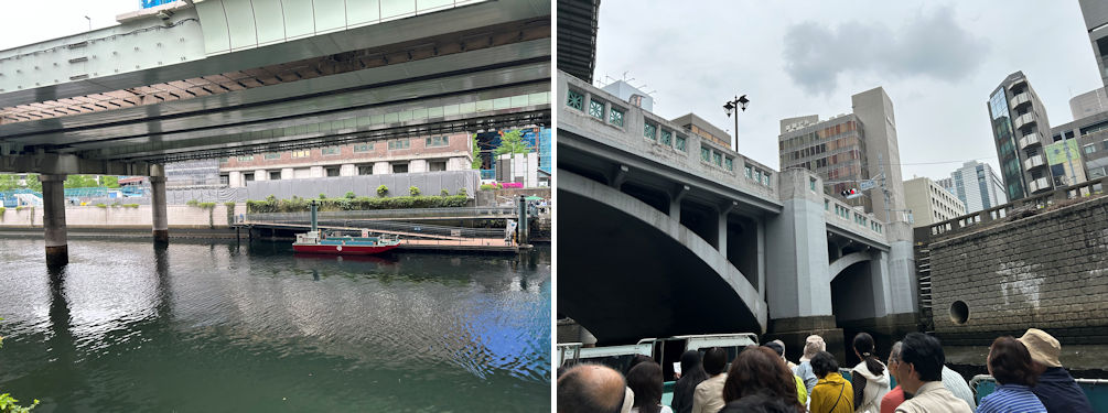
The boat had seating capacity of slightly less than forty without any roof (left). We were advised that it didn’t matter where we sat, as we would all be looking upward in general (right).
As can be seen from the map above, Nihonbashi River flows under the Metropolitan Expressway routes C1 and Route 5 from Nihonbashi to near Edogawabashi Junction. To be more precise, the promotion of the construction of the Metropolitan Expressway began in the 1950s when Japan's economic growth started to accelerate. In particular, in order to avoid densely populated areas and utilize vacant land, many parts of the expressway were constructed over rivers such as the Nihonbashi River in the central city area. The central city section was largely completed by the 1964 Tokyo Olympics. What I was pleasantly surprised with on this cruise was the almost complete absence of river odor. This was a welcome surprise for someone like me who still remembers the discolored and malodorous rivers of urban areas. In fact, construction has begun to bury part of the expressway underground in the Nihonbashi area in order to improve the scenery, among other reasons. As a result, the first section of the cruise route, from Nihonbashi to Kanda, will once again be under the open sky. However, the opening is not expected until around 2040.
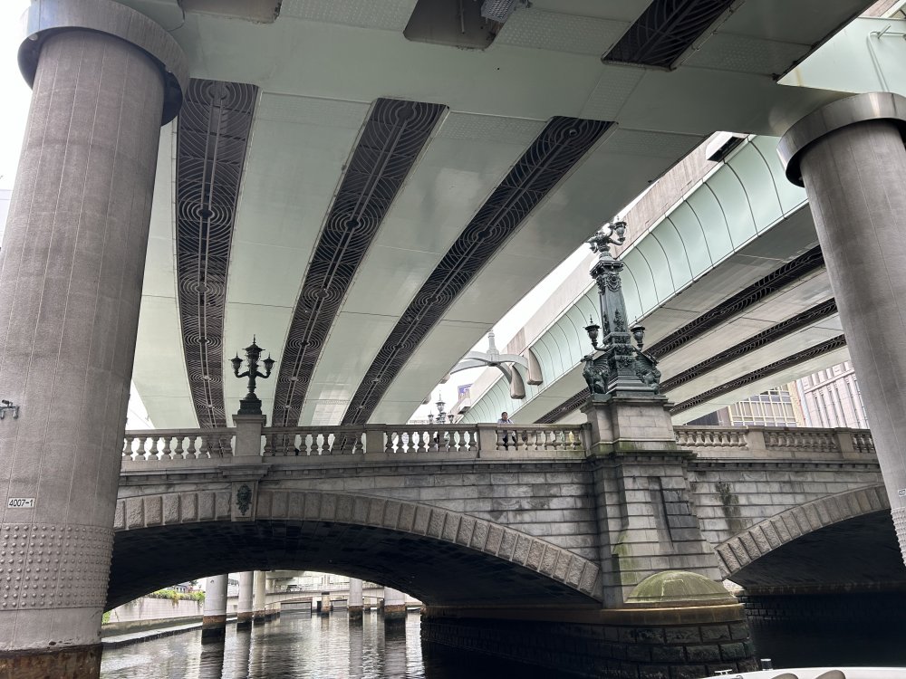
Nihonbashi River flows under the Metropolitan Expressway routes C1 and Route 5 from Nihonbashi to near Edogawabashi Junction. Metrpolitan Expressway just above and almost hiding Nihonbashi Bridge.
The boat cruised Nihonbashi River upstream in the northwestern direction toward Koishikawa, just west of Suidobashi, where it merges into the Kandagawa River. It appears that Nihonbashi River which flows south east from Koishikawa and merges into Sumida River was part of the former outer moat of Edo Castle that remains to this day. It has a length of approximately five kilometers. From Nihonbashi, the river goes past Bank of Japan, travels north of Tokyo Station before merging into Kandagawa River. Kandagawa River is a river that has its source in Inogashira Park, in Musashino City, about 20 kilometers west of central Tokyo. It flows east, then north to Takadanobaba, south to Iidabashi, and then further east where it merges with Sumida River in the Ryogoku area. It was one of the main drinking water source for Edo which already had a population of one million in the early 18th century. The section between Iidabashi and Koishikawa also served as the northern part of Edo Castle’s outer moat. From Iidabashi, the former outer moat stretched south to Yotsuya, Akasaka, and then east to the Hibiya area. Most parts of the outer moat of Edo Castle on the western and south side has been largely filled in and converted into a major road (Sotobori-doori).
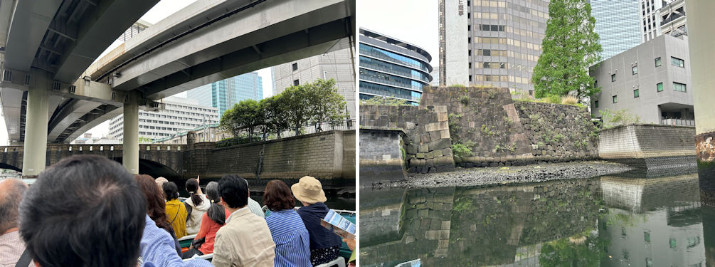
We passed by the main building of Bank of Japan, designed by King Tatsuno, completed in 1896, and designated as an important cultural heritage (left). On the left bank, stones from Edo Castle's walls still remain, indicating that this section of the Nihonbashi River was once part of the outer moat. Eastern side of the Otemachi business area (right).
The boat made a right turn and entered the Kandagawa River. I don’t want to puzzle you, but I now understand that this part of the Kandagawa River to its mouth in Sumida River was not the original Kandagawa River. In the early Edo era, Kandagawa River flowed into what is now Nihonbashi River. Starting from the early 17th century, shortly after the start of the Tokugawa military government, the Tokugawa shogun family ordered the feudal lords of Sendai, the Date Family to divert Kandagawa River eastward to its current course to mitigate flooding in the area and enhance the outer moat's defensive capabilities. For this reason, this part of the Kandagawa River is also known as “Date-bori (Date Moat)”.
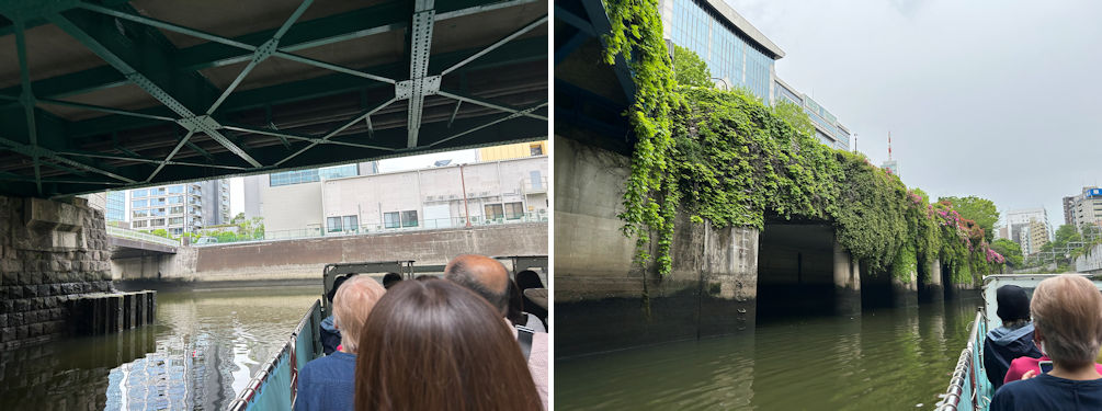
We came to the Korakuen area where Nihonbasi River meets Kandagawa River (lefT). Actually Nihonbasi River was the route Kandagawa River took in the early Edo era. We made a right turn into Kandagawa River. this part of the Kandagawa River is also known as “Date-bori (Date Moat)” (right).
One of the first bridges on Kandagawa River that we passed under was Suidobashi (Suido Bridge). I have been in the Suidobashi area, not far from the Kanda district countless times, but until this cruise, I only thought of the area, and not the bridge itself. The current bridge is a steel bridge rebuilt in 1988, but it seems that the first bridge was built in the 1670s. The name "Suidobashi" is said to come from the fact that a conduit that carried water from the upper reaches of the Kanda River to Edo crossed the river a little downstream from this bridge. Suido literally means “water path”.
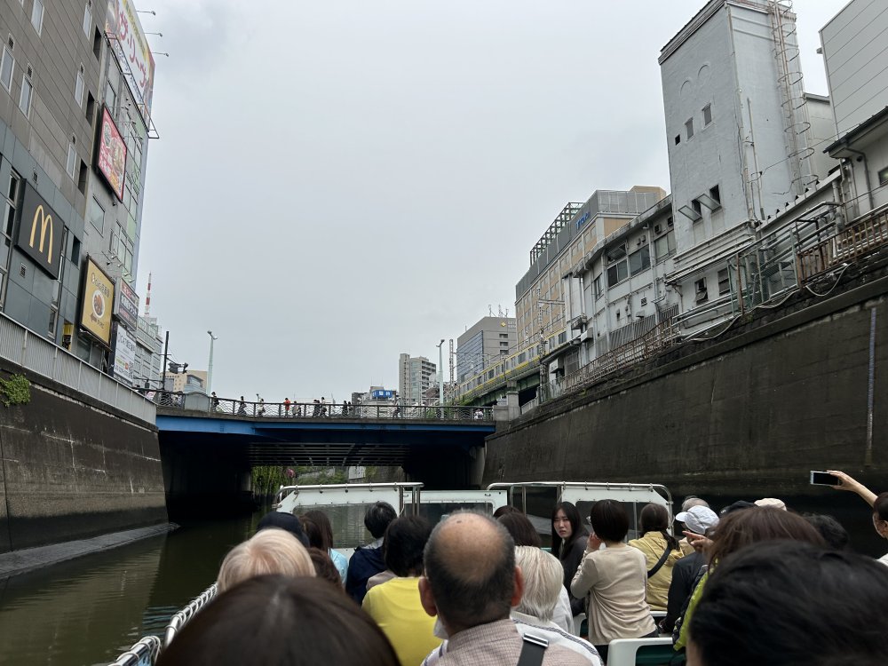
The boat as it approaches Suidobashi. I have been in the Suidobashi area, not far from the Kanda district countless times, but until this cruise, I only thought of the area, and not the bridge itself.
We went past Suidobashi to the Ochanomizu and Akihabara Electric goods district. Our guide had drawn attention to the greenery that remains along the river banks. The vegetation between Suidobashi and Ochanomizu was particularly lush, and was most reminiscent of the name "Jungle Cruise" given to this cruise.
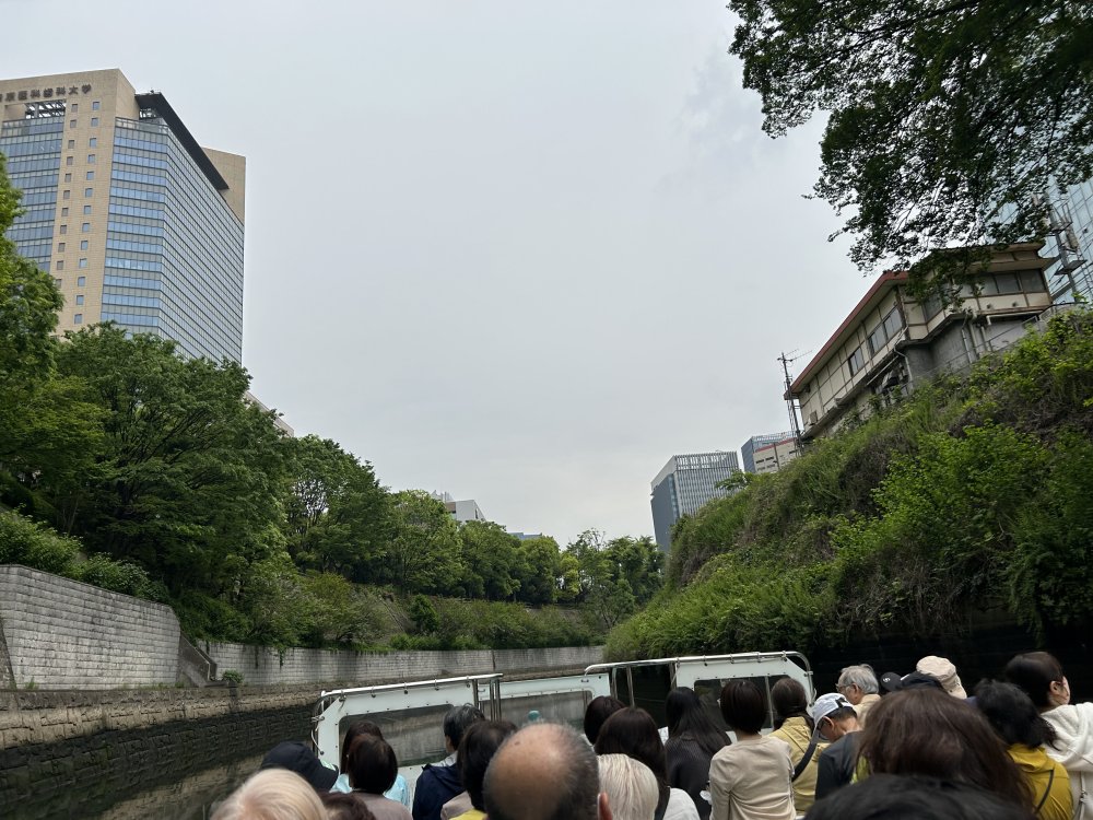
The vegetation between Suidobashi and Ochanomizu was particularly lush, and was most reminiscent of the name "Jungle Cruise" given to this cruise.
We reached the Asakusabashi area. The district of Asakusabashi is famous for its yakatabune. Yakatabune are traditional Japanese riverboats with a roof and tatami mat seating, primarily used for banquets and dining on the water. Their origins can be traced back to the Heian period (794-1185), when they were used for entertainment by nobles. They flourished during the Edo period (1603-1868) when river development progressed, and were favored by daimyo (feudal lords), wealthy merchants, and others for enjoying cherry blossom viewing, moon viewing, and fireworks. In particular, the yakatabune of Edo, running from Asakusabashi to the Sumida River, were lavishly decorated with gold, silver, and lacquer. I recall that their operation was suspended due to the high risk posed by the coronavirus pandemic. I do hope they will regain their popularity.
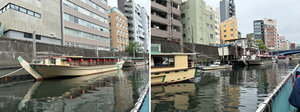
There are still quite a few yakatabune operators in the Asakusabashi area offering full course menus during lunch and evening cruises. Some have English brochures.
We traveled further east to join Sumida River at the Ryogoku area. Sumida River in the Edo era marked the eastern perimeter of Edo. East of the river was Kazusa, now Chiba Prefecture. Sumida River is one of my favorite places I take travelers visiting Japan for the first time, because of its proximity to Asakusa, and the boat cruises to Tokyo Bay.
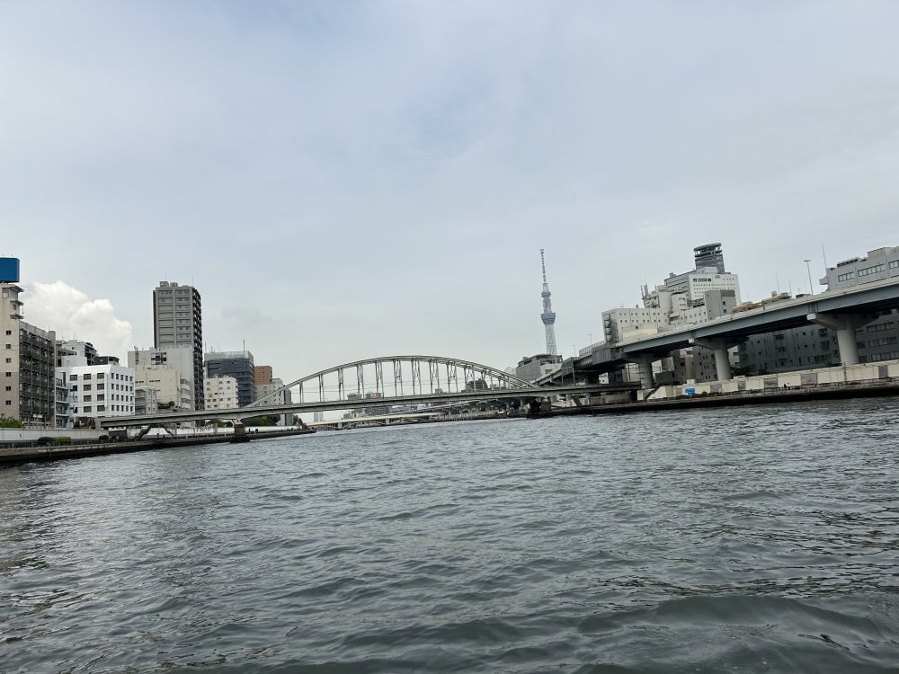
Kandagwa joins Sumida River just south of Ryogoku. A view to the north from the boat, with Ryogokubashi Bridge right in front and Tokyo Skytree in the far back.
It wasn’t long before the boat swerved west to enter Nihonbashi River, leading us back to where we started. The drizzle in the morning had let up, and the cruise was really pleasant. We returned to Nihonbashi. The 90 minutes’ cruise certainly gave me a lot to digest. The view from the rivers were completely different from the views above. This was certainly a great opportunity to Rediscover Tokyo!
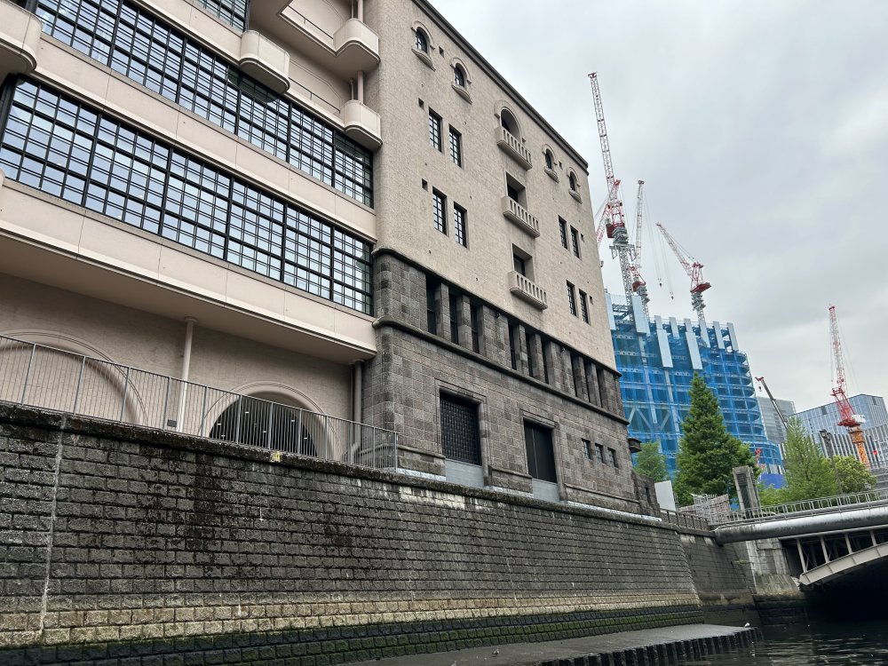
We passed by the Kabutocho district (stock market district). The guide advised us that there's a Kabuto Shinto Shrine tucked behind the building on the left by the bridge. I only managed to catch a glimpse as it is almost hidden in the trees of the small shrine grounds.